
Advance your sustainability decision-making with trusted agri-food data
LCA DATABASE FOR FOOD & AGRICULTURE
Agri-footprint is the world’s leading environmental footprint database dedicated to the agri-food sector. Gain deep insights into the environmental impact of your products and services using comprehensive, consistent, comparable data trusted by industry leaders, LCA experts, research institutions, and policymakers worldwide.

✔ ISO 14040/44 reviewed
✔ PEF aligned
✔ SBTi FLAG ready
WHY CHOOSE AGRI-FOOTPRINT?
Confidently close your data gaps
Calculating environmental footprints in the agri-food sector requires background data that reflects real-world farming, regional trade, and complex supply chains. Generic LCA databases often lack the agricultural specificity needed to close data gaps for accurate Scope 3 reporting, product footprints, or software tools.
Agri-footprint bridges this gap. Developed by food system sustainability experts at Mérieux NutriSciences | Blonk, it delivers comprehensive, consistent, and methodologically sound LCA & footprint datasets trusted by experts worldwide.
LCA specialists & consultants
Reliable background data that accelerates footprint calculations and holds up under scrutiny.
Sustainability leaders
The precision you need for accurate Scope 3 accounting and audit-ready CSRD reporting.
Software developers
Clean, standardized secondary datasets that integrate seamlessly into footprint calculators and platforms.
WHAT’S INSIDE
Full-coverage supply chain data, from field to market.
10,000+ agri-food datasets
Crops, intermediate processes, feed compounds, food products and livestock systems, plus background inputs like transport, energy, pesticides and fertilizers.
Compliant with international standards
Built to support the European Product Environmental Footprint (PEF), IPCC guidelines and ISO 14040/44.
Robust, consistent methodology
Official statistics, scientific literature, primary industry data and expert modelling, with publicly available background methodologies.
Global scope, regional granularity
National and regional data for key producing countries, including state-level resolution for major agricultural markets.
Agri-footprint news
Learn more: featured articles, customer stories and other

What’s new in Agri-footprint 8?
Agri-footprint 8 is the most significant update of our LCA database as of yet, featuring a large scope expansion alongside many methodological updates and data actualization.
Agri-footprint 8 has undergone a critical review by independent experts, ensuring data integrity and methodological quality for your LCA and footprint calculations.

Scaling from 4,800 to 10,000 datasets
Access 2,600+ new fruit & vegetable datasets and state-level geographies for precise, audit-ready LCA calculations.
Agri-footprint 8 launches this summer with its biggest data expansion yet, doubling to 10,000 datasets.
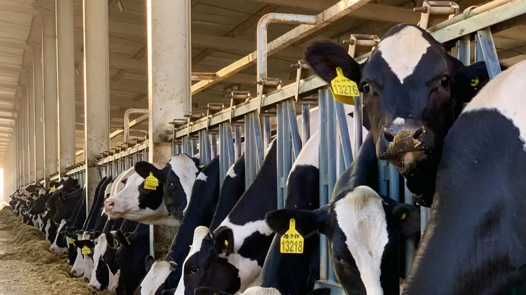
Agri-footprint 8’s animal systems overhaul
Access 2,600+ new fruit & vegetable datasets and state-level geographies for precise, audit-ready LCA calculations.
Agri-footprint 8 launches this summer with its biggest data expansion yet, doubling to 10,000 datasets.
GEOGRAPHICAL COVERAGE
From 74 to 186 geographical regions
U.S. states
Model U.S. field crops at state level instead of relying on a national average.
Australian states
Regional data for horticulture such as avocados, mangoes, citrus and nuts.
Country baselines
Previously data-scarce sourcing regions, including Ecuador, Kazakhstan and Vietnam.
Production mixes
PEFCR-aligned, volume-weighted regional averages for when the exact origin is unknown.
How we maintain data quality and integrity
Automated
data generation
Built using our Data Generation Pipeline, Agri-footprint replaces manual dataset creation with automated, code-based execution. This ensures complete consistency across all 10,000+ datasets, full traceability, and reproducible results.

Up-to-date
statistical baselines
Statistical inputs, including crop yields, pesticide application rates, trade flows, and Land Use Change (LUC), are systematically synchronized to a rolling 5-year average alongside spatial GIS modelling.

Independent
external review
Agri-footprint 8 has been reviewed by external LCA experts of Agroscope, in accordance with ISO 14040/44 standards to guarantee data quality.

Which version fits your needs?
Agri-footprint: Ideal for general life cycle assessments (LCA), supply chain hot spot analyses, product footprinting,
and comparative environmental studies.
Agri-footprint FLAG: Tailored for compliance with the Science Based Targets
initiative (SBTi) Forest, Land, and Agriculture (FLAG) Guidance. It features SBTi-
aligned impact categorization, 20-year linear discounting, and Land Occupation
metrics to streamline target setting and GHG inventory reporting
SUPPORT & RESOURCES
Documentation, bugs and FAQ
To us, transparency is essential in developing sustainable agri-food value chains. This is why we want to be open about all currently known bugs and issues in Agri-footprint, including our envisioned solution. Did you find a bug? Please report it to us.
Agri-footprint
Resources for the standard version of Agri-footprint, used in LCA and product footprinting.
Agri-footprint FLAG
Resources for the SBTi ready version.
Blonk Data Hub
Cloud access for every licensee
Every Agri-footprint licensee can now access the database via the cloud-based Blonk Data Hub. You can now access environmental impact data through an intuitive interface.
With a few simple clicks, you can:
- Access to different versions of Agri-footprint via the same interface (depending on your license)
- Intuitively search and filter datasets instantly
- Get one-click access to data sources, background methodologies and process insights

Get your Agri-footprint license today!
Whether you are looking to purchase a standalone license, upgrade your existing database version, or integrate Agri-footprint into your software platform, we offer flexible licensing models to fit your needs.